
泉大津市 topographic map
Interactive map
Click on the map to display elevation.
About this map
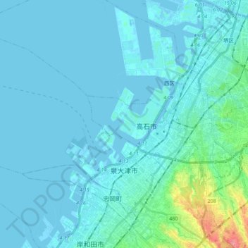
Name: 泉大津市 topographic map, elevation, terrain.
Location: 泉大津市, 大阪府, 日本 (34.48150 135.26245 34.58452 135.43507)
Average elevation: 10 m
Minimum elevation: -7 m
Maximum elevation: 112 m
Other topographic maps
Click on a map to view its topography, its elevation and its terrain.