
池田市 topographic map
Interactive map
Click on the map to display elevation.
About this map
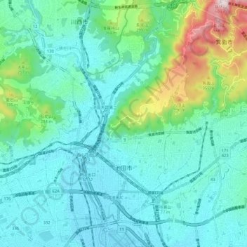
Name: 池田市 topographic map, elevation, terrain.
Location: 池田市, 大阪府, 日本 (34.79177 135.41599 34.87713 135.46081)
Average elevation: 124 m
Minimum elevation: 11 m
Maximum elevation: 594 m
Other topographic maps
Click on a map to view its topography, its elevation and its terrain.