
旭區 topographic map
Interactive map
Click on the map to display elevation.
About this map
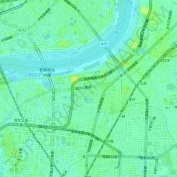
Name: 旭區 topographic map, elevation, terrain.
Location: 旭區, 大阪市, 大阪府, 日本 (34.71150 135.52586 34.74608 135.56763)
Average elevation: 6 m
Minimum elevation: -2 m
Maximum elevation: 15 m
Other topographic maps
Click on a map to view its topography, its elevation and its terrain.