
枚方市 topographic map
Interactive map
Click on the map to display elevation.
About this map
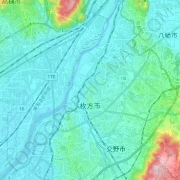
Name: 枚方市 topographic map, elevation, terrain.
Location: 枚方市, 大阪府, 日本 (34.77308 135.61426 34.88134 135.74660)
Average elevation: 42 m
Minimum elevation: -6 m
Maximum elevation: 330 m
Other topographic maps
Click on a map to view its topography, its elevation and its terrain.