
若竹池 topographic map
Interactive map
Click on the map to display elevation.
About this map
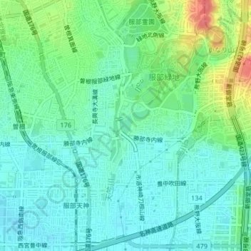
Name: 若竹池 topographic map, elevation, terrain.
Location: 若竹池, 城山町四丁目, 豐中市, 大阪府, 日本 (34.76952 135.48077 34.77158 135.48259)
Average elevation: 19 m
Minimum elevation: 1 m
Maximum elevation: 66 m