
茨木市 topographic map
Interactive map
Click on the map to display elevation.
About this map
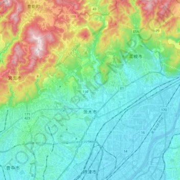
Name: 茨木市 topographic map, elevation, terrain.
Location: 茨木市, 大阪府, 日本 (34.77544 135.49578 34.92892 135.60626)
Average elevation: 169 m
Minimum elevation: -4 m
Maximum elevation: 667 m
Other topographic maps
Click on a map to view its topography, its elevation and its terrain.