
淀川河川公園大塚地区 topographic map
Interactive map
Click on the map to display elevation.
About this map
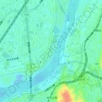
Name: 淀川河川公園大塚地区 topographic map, elevation, terrain.
Location: 淀川河川公園大塚地区, 高槻市, 大阪府, 日本 (34.81604 135.63270 34.82939 135.64240)
Average elevation: 10 m
Minimum elevation: -8 m
Maximum elevation: 43 m