
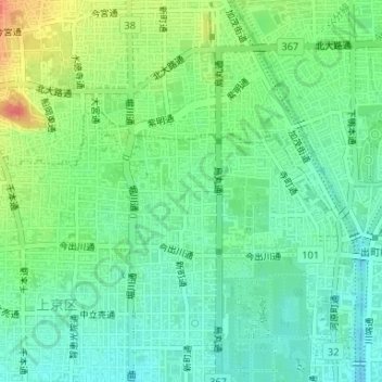
新生さくら広場 topographic map
Interactive map
Click on the map to display elevation.
About this map
Name: 新生さくら広場 topographic map, elevation, terrain.
Location: 新生さくら広場, 古木町, 上京区, 京都市, 京都府, 日本 (35.03352 135.75678 35.03367 135.75707)
Average elevation: 66 m
Minimum elevation: 45 m
Maximum elevation: 106 m
Other topographic maps
Click on a map to view its topography, its elevation and its terrain.