
東山区 topographic map
Interactive map
Click on the map to display elevation.
About this map
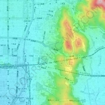
Name: 東山区 topographic map, elevation, terrain.
Location: 東山区, 京都市, 京都府, 日本 (34.96996 135.76464 35.01085 135.79114)
Average elevation: 79 m
Minimum elevation: 22 m
Maximum elevation: 299 m
Other topographic maps
Click on a map to view its topography, its elevation and its terrain.