
西陣児童公園 topographic map
Interactive map
Click on the map to display elevation.
About this map
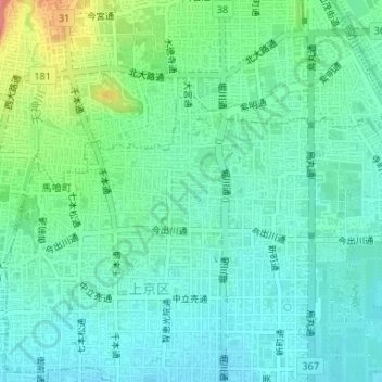
Name: 西陣児童公園 topographic map, elevation, terrain.
Location: 西陣児童公園, 樋之口町, 上京区, 京都市, 京都府, 日本 (35.03225 135.74882 35.03270 135.74920)
Average elevation: 69 m
Minimum elevation: 48 m
Maximum elevation: 130 m
Other topographic maps
Click on a map to view its topography, its elevation and its terrain.