
行方市 topographic map
Interactive map
Click on the map to display elevation.
About this map
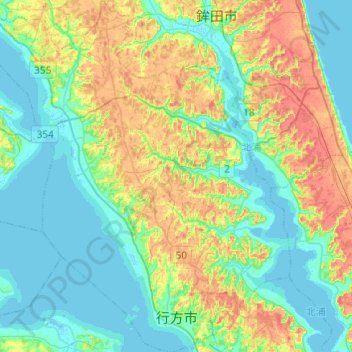
Name: 行方市 topographic map, elevation, terrain.
Location: 行方市, 茨城县, 日本 (35.96996 140.36173 36.16632 140.56769)
Average elevation: 17 m
Minimum elevation: -4 m
Maximum elevation: 48 m
Other topographic maps
Click on a map to view its topography, its elevation and its terrain.
白石川堤一目千本桜 桜のトンネル
白石川堤一目千本桜 桜のトンネル, 柴田バイパス, 槻木白幡五丁目, 槻木白幡, 柴田町, 柴田郡, 宫城县, 989-1622, 日本
Average elevation: 19 m