
国指定史跡黒浜貝塚 topographic map
Interactive map
Click on the map to display elevation.
About this map
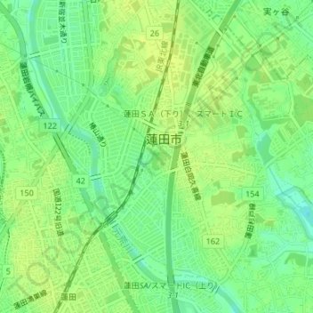
Name: 国指定史跡黒浜貝塚 topographic map, elevation, terrain.
Location: 国指定史跡黒浜貝塚, 蓮田市, 埼玉县, 日本 (35.99123 139.66059 35.99365 139.66413)
Average elevation: 14 m
Minimum elevation: 4 m
Maximum elevation: 20 m