
永平寺町 topographic map
Interactive map
Click on the map to display elevation.
About this map
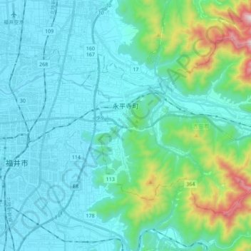
Name: 永平寺町 topographic map, elevation, terrain.
Location: 永平寺町, 吉田郡, 福井県, 中部地方, 910-1228, 日本 (36.03351 136.26997 36.13006 136.43935)
Average elevation: 149 m
Minimum elevation: 3 m
Maximum elevation: 926 m