
東海市 topographic map
Interactive map
Click on the map to display elevation.
About this map
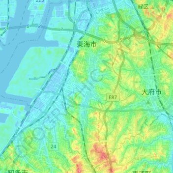
Name: 東海市 topographic map, elevation, terrain.
Location: 東海市, 爱知县, 中部地方, 日本 (34.96955 136.83791 35.06893 136.94035)
Average elevation: 16 m
Minimum elevation: -9 m
Maximum elevation: 70 m
Other topographic maps
Click on a map to view its topography, its elevation and its terrain.