
大村市 topographic map
Interactive map
Click on the map to display elevation.
About this map
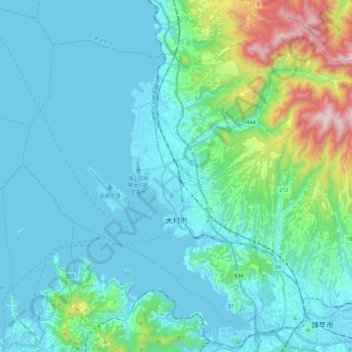
Name: 大村市 topographic map, elevation, terrain.
Location: 大村市, 长崎县, 日本 (32.84337 129.85887 33.00414 130.08683)
Average elevation: 135 m
Minimum elevation: -1 m
Maximum elevation: 867 m
Other topographic maps
Click on a map to view its topography, its elevation and its terrain.