
尾花澤市 topographic map
Interactive map
Click on the map to display elevation.
About this map
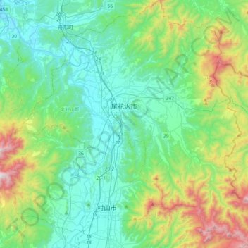
Name: 尾花澤市 topographic map, elevation, terrain.
Location: 尾花澤市, 山形县, 日本 (38.43654 140.31271 38.72172 140.62001)
Average elevation: 337 m
Minimum elevation: 34 m
Maximum elevation: 1,342 m
Other topographic maps
Click on a map to view its topography, its elevation and its terrain.