
新居滨市 topographic map
Interactive map
Click on the map to display elevation.
About this map
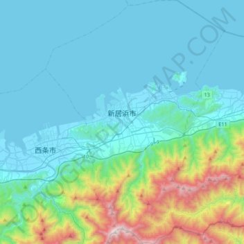
Name: 新居滨市 topographic map, elevation, terrain.
Location: 新居滨市, 爱媛县, 日本 (33.81468 133.18143 34.08470 133.45545)
Average elevation: 307 m
Minimum elevation: -3 m
Maximum elevation: 1,850 m
Other topographic maps
Click on a map to view its topography, its elevation and its terrain.