
南房總市 topographic map
Interactive map
Click on the map to display elevation.
About this map
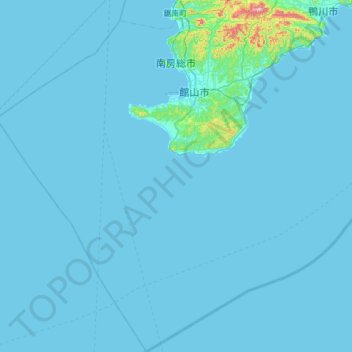
Name: 南房總市 topographic map, elevation, terrain.
Location: 南房總市, 千叶县, 日本 (34.61682 139.65181 35.12872 140.19912)
Average elevation: 11 m
Minimum elevation: 0 m
Maximum elevation: 397 m
Other topographic maps
Click on a map to view its topography, its elevation and its terrain.
白石川堤一目千本桜 桜のトンネル
白石川堤一目千本桜 桜のトンネル, 柴田バイパス, 槻木白幡五丁目, 槻木白幡, 柴田町, 柴田郡, 宫城县, 989-1622, 日本
Average elevation: 19 m