
黑龙江省森林植物园 topographic map
Interactive map
Click on the map to display elevation.
About this map
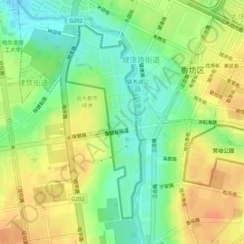
Name: 黑龙江省森林植物园 topographic map, elevation, terrain.
Location: 黑龙江省森林植物园, 建筑街道, 香坊区, 哈尔滨市, 黑龙江省, 150000, 中国 (45.68954 126.63673 45.71114 126.64883)
Average elevation: 155 m
Minimum elevation: 136 m
Maximum elevation: 173 m
Other topographic maps
Click on a map to view its topography, its elevation and its terrain.