
松北区 topographic map
Interactive map
Click on the map to display elevation.
About this map
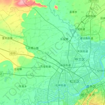
Name: 松北区 topographic map, elevation, terrain.
Location: 松北区, 哈尔滨市, 黑龙江省, 150000, 中国 (45.73067 126.16344 46.09339 126.71066)
Average elevation: 127 m
Minimum elevation: 112 m
Maximum elevation: 196 m
Other topographic maps
Click on a map to view its topography, its elevation and its terrain.