
道外区 topographic map
Interactive map
Click on the map to display elevation.
About this map
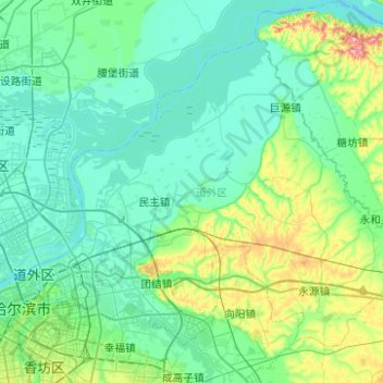
Name: 道外区 topographic map, elevation, terrain.
Location: 道外区, 哈尔滨市, 黑龙江省, 150000, 中国 (45.72382 126.61735 46.00461 127.11362)
Average elevation: 139 m
Minimum elevation: 111 m
Maximum elevation: 279 m
Other topographic maps
Click on a map to view its topography, its elevation and its terrain.