
南岗区 topographic map
Interactive map
Click on the map to display elevation.
About this map
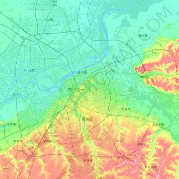
Name: 南岗区 topographic map, elevation, terrain.
Location: 南岗区, 哈尔滨市, 黑龙江省, 150009, 中国 (45.59809 126.50263 45.91809 126.82263)
Average elevation: 140 m
Minimum elevation: 112 m
Maximum elevation: 207 m
Other topographic maps
Click on a map to view its topography, its elevation and its terrain.