
孙吴县 topographic map
Interactive map
Click on the map to display elevation.
About this map
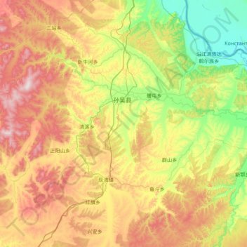
Name: 孙吴县 topographic map, elevation, terrain.
Location: 孙吴县, 黑河市, 黑龙江省, 164300, 中国 (48.97458 126.68909 49.69498 128.01993)
Average elevation: 333 m
Minimum elevation: 107 m
Maximum elevation: 756 m
孫吳縣屬於低山丘陵區,海拔在110—755米之間,地勢南部和西部高,北部和東部低,由西南向東北逐漸傾斜。地貌分區較明顯,西部為低山溝谷區,中部為丘陵河谷地區,東北部為沿江平原。
Other topographic maps
Click on a map to view its topography, its elevation and its terrain.