Geolocate

Carmarthenshire topographic map

Interactive map

Click on the map to display elevation.

About this map

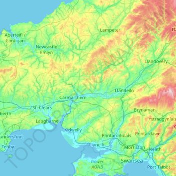
Name: Carmarthenshire topographic map, elevation, terrain.

Location: Carmarthenshire, Wales, United Kingdom (51.64495 -4.72308 52.14240 -3.64713)

Average elevation: 142 m

Minimum elevation: -1 m

Maximum elevation: 794 m

Other topographic maps

Click on a map to view its topography, its elevation and its terrain.

Harlech

United Kingdom > Wales > Gwynedd

Average elevation: 68 m

Rhigos

United Kingdom > Wales > Rhondda Cynon Taf

Average elevation: 274 m

Pwllheli

United Kingdom > Wales > Gwynedd

Average elevation: 22 m

Ynysybwl

United Kingdom > Wales > Rhondda Cynon Taf

Average elevation: 209 m

Libanus

United Kingdom > Wales > Powys

Average elevation: 272 m

Minera

United Kingdom > Wales > Wrexham

Average elevation: 278 m

Bwlchgwyn

United Kingdom > Wales > Wrexham

Average elevation: 293 m

Roath Park

United Kingdom > Wales > Cardiff > Cardiff

Average elevation: 37 m

Rhuddlan

United Kingdom > Wales > Denbighshire

Average elevation: 12 m

Machynlleth

United Kingdom > Wales > Powys

Average elevation: 140 m

Tintern

United Kingdom > Wales > Monmouthshire

Average elevation: 139 m

Llanishen

United Kingdom > Wales > Monmouthshire

Average elevation: 155 m

Milford

United Kingdom > Wales > Powys

Average elevation: 172 m

Rhydcymerau

United Kingdom > Wales > Carmarthenshire

Average elevation: 256 m

Dwygyfylchi

United Kingdom > Wales > Conwy

Average elevation: 99 m

Aberporth

United Kingdom > Wales > Ceredigion

Average elevation: 62 m

Pumsaint

United Kingdom > Wales > Carmarthenshire

Average elevation: 181 m

Chepstow

United Kingdom > Wales > Monmouthshire

Average elevation: 57 m

Swansea

United Kingdom > Wales > Swansea

Much of Swansea is hilly with the main area of upland being located in the council ward of Mawr. Areas up to 185 metres (607 ft) in elevation range across the central section: Kilvey Hill, Townhill and Llwynmawr separate the centre of Swansea from its northern suburbs. Cefn Bryn, a ridge of high land, is the…

Average elevation: 73 m

Aberystwyth

United Kingdom > Wales > Ceredigion

Aberystwyth experiences an oceanic climate (Köppen climate classification Cfb) similar to almost all of the United Kingdom. This is particularly pronounced due to its west coast location facing the Irish Sea. Air undergoes little land moderation and so temperatures closely reflect the sea temperature when…

Average elevation: 39 m

Llwynmawr

United Kingdom > Wales > Wrexham

Average elevation: 298 m

Rhes-y-cae

United Kingdom > Wales > Flintshire

Average elevation: 225 m

Cardigan

United Kingdom > Wales > Ceredigion > Cardigan

Average elevation: 81 m

Carmarthen

United Kingdom > Wales > Carmarthenshire > Carmarthen

Average elevation: 74 m

Ynyslas

United Kingdom > Wales > Ceredigion > Borth > Ynyslas

Average elevation: 1 m

St Hilary

United Kingdom > Wales > Vale of Glamorgan > St Hilary

Average elevation: 66 m

Trefechan

United Kingdom > Wales > Trefechan

Average elevation: 298 m

Merrion

United Kingdom > Wales > Pembrokeshire > Warren

Average elevation: 44 m

Carew

United Kingdom > Wales > Carew

Average elevation: 31 m

Bridgend

United Kingdom > Wales > Bridgend

Average elevation: 57 m

Y Lordship

United Kingdom > Wales

Average elevation: 278 m

Stepaside

United Kingdom > Wales > Powys

Average elevation: 196 m

Burry Port

United Kingdom > Wales > Burry Port

Average elevation: 36 m

Llaneglwys

United Kingdom > Wales > Llaneglwys

Average elevation: 344 m

Llanelli

United Kingdom > Wales > Llanelli

Average elevation: 41 m

Merthyr Tydfil

United Kingdom > Wales > Merthyr Tydfil

Average elevation: 313 m

Caerleon

United Kingdom > Wales > Newport > Caerleon

Average elevation: 37 m

Tavernspite

United Kingdom > Wales > Tavernspite

Average elevation: 148 m

Holywell

United Kingdom > Wales > Holywell

Average elevation: 119 m

Rhyl

United Kingdom > Wales > Denbighshire > Rhyl

Average elevation: 5 m

Llanidloes

United Kingdom > Wales > Powys > Llanidloes

Average elevation: 267 m

Trinant

United Kingdom > Wales > Caerphilly > Pentwyn > Trinant

Average elevation: 256 m