
Burry Port topographic map
Interactive map
Click on the map to display elevation.
About this map
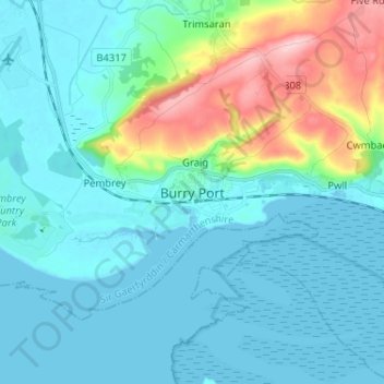
Name: Burry Port topographic map, elevation, terrain.
Location: Burry Port, Carmarthenshire, Wales, SA16 0LL, United Kingdom (51.64582 -4.29022 51.72582 -4.21022)
Average elevation: 36 m
Minimum elevation: -3 m
Maximum elevation: 190 m