
Thank you for supporting this site ❤️
Make a donation
Make a donation
Gear up for your next adventure:
As an Amazon Associate, this site earns from qualifying purchases at no extra cost to you.
Aberporth topographic map
Click on the map to display elevation.
Thank you for supporting this site ❤️
Make a donation
Make a donation
Gear up for your next adventure:
As an Amazon Associate, this site earns from qualifying purchases at no extra cost to you.
About this map
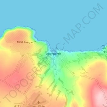
Name: Aberporth topographic map, elevation, terrain.
Location: Aberporth, Ceredigion, Wales, SA43 2DB, United Kingdom (52.11417 -4.56622 52.15417 -4.52622)
Average elevation: 62 m
Minimum elevation: 0 m
Maximum elevation: 184 m
Thank you for supporting this site ❤️
Make a donation
Make a donation
Gear up for your next adventure:
As an Amazon Associate, this site earns from qualifying purchases at no extra cost to you.