
Llwynmawr topographic map
Interactive map
Click on the map to display elevation.
About this map
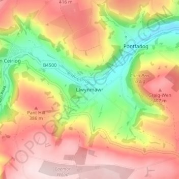
Name: Llwynmawr topographic map, elevation, terrain.
Location: Llwynmawr, Wrexham, Wales, LL20 7BA, United Kingdom (52.90511 -3.17791 52.94511 -3.13791)
Average elevation: 298 m
Minimum elevation: 119 m
Maximum elevation: 446 m