
France topographic map
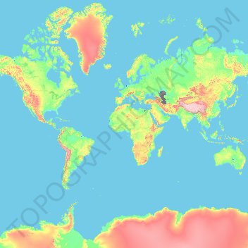
Interactive map
Click on the map to display elevation.
France
France's topography presents a rich tapestry of varied landscapes, ranging from expansive plains to towering mountain ranges. In the north and west, the terrain is predominantly composed of flat plains and gently rolling hills, exemplified by the Paris Basin, which offers fertile soils ideal for agriculture. Contrastingly, the eastern and southern regions are marked by significant mountainous formations. The Alps in the east boast Mont Blanc, Western Europe's highest peak at 4,810 meters (15,781 feet), while the Pyrenees form a natural barrier along the Spanish border, characterized by rugged peaks and deep valleys. Central France is dominated by the Massif Central, an ancient highland region featuring a mix of plateaus and extinct volcanic peaks. Additionally, the Jura Mountains along the eastern frontier and the Vosges in the northeast contribute to the country's diverse elevation profile. France also boasts a lengthy coastline along the Atlantic Ocean, the Mediterranean Sea and the English Channel, with cliffs, sandy beaches, and rocky coves. The country’s varied topography contributes to its rich biodiversity, from alpine meadows to Mediterranean scrublands.
About this map
Name: France topographic map, elevation, terrain.
Location: France (-50.21872 -178.38737 51.30557 172.30572)
Average elevation: 430 m
Minimum elevation: -30 m
Maximum elevation: 6,542 m
Other topographic maps
Click on a map to view its topography, its elevation and its terrain.
Dankuni
India > West Bengal > Chanditala - II
Located at an elevation of None meters (0 feet) above sea level, city's yearly temperature is 30.28 °C (86.5 °F) and it is 4.31% higher than India's averages. Dankuni typically receives about 150.21 millimeters (5.91 inches) of precipitation and has 150.54 rainy days (41.24% of the time) annually.
Average elevation: 6 m
Tbilisi
Most of the raions are named after historic quarters of the city. The citizens of Tbilisi widely recognise an informal system of smaller historic neighbourhoods. Such neighbourhoods are several, however, constituting a kind of hierarchy, because most of them have lost their distinctive topographic limits. The…
Average elevation: 713 m
Europe
Europe's topography is characterized by a striking contrast between its rugged southern mountains and the expansive plains of the north. The continent is often described as a "peninsula of peninsulas," featuring major peninsulas like the Iberian, Italian, and Balkan, each with unique geological features. In…
Average elevation: 223 m
Cedar
Canada > British Columbia > Regional District of Nanaimo > Area A (Cassidy/Cedar)
Average elevation: 27 m
Laguna de Santo Tomás
Mexico > Baja California > Municipio de Ensenada > La Bocana
Average elevation: 40 m
Lusaka
Lusaka (/luːˈsɑːkə/ loo-SAH-kə) is the capital and largest city of Zambia. It is one of the fastest-developing cities in southern Africa. Lusaka is in the southern part of the central plateau at an elevation of about 1,279 metres (4,196 ft). As of 2019, the city's population was about 3.3 million, while…
Average elevation: 1,227 m
Big Sur
United States > California > Monterey County
The highest peaks of the crest of the coast range are located at an average distance from the coast of three and a half miles [5.6 km]. In this distance they rise to elevations of from three thousand six hundred to five thousand feet [1,100 to 1,500 m] above the sea-level. From San Carpoforo Creek to…
Average elevation: 193 m
Country Club Estates
United States > North Carolina > Alamance County > Burlington
Average elevation: 195 m
Svinjašnica
Bosnia and Herzegovina > Federation of Bosnia and Herzegovina > Town of Zavidovići
Average elevation: 446 m
Vredefort
South Africa > Free State > Fezile Dabi District Municipality > Ngwathe Local Municipality
Average elevation: 1,430 m
Tankovoye
Ukraine > Republic of Crimea > Bakhchysarai Raion > Куйбышевское сельское поселение
Average elevation: 169 m
Monument
United States > Colorado > El Paso County
Monument experiences a hemiboreal continental climate (Köppen Dfb) with warm, relatively rainy summers and cold, snowy winters. The semi-arid climate keeps the dew point very low in Monument year-round which causes the air to feel quite dry. Monument is part of the Front Range urban corridor and lies on the…
Average elevation: 2,160 m
Malvern
United Kingdom > England > Worcestershire > Malvern Hills
Malvern lies in the Lower Severn/Avon plain affording it a degree of shelter caused by virtue of its nestling in between the Cotswold hills to the east, the Welsh Hills and Mountains to the west, and Birmingham plateau to the north. Although as with all the British Isles it has a maritime climate, the local…
Average elevation: 95 m
Tassili n'Ajjer
Tassili n'Ajjer lies within the West Saharan montane xeric woodlands ecoregion. Due to the higher elevation of the area, coupled with the water-retentive properties of the sandstone, the vegetation here is somewhat more lush and verdant than in the lower regions of desert; in turn, this creates an attractive…
Average elevation: 842 m
Toowoomba
The city occupies the edge of the range and the low ridges behind it. Two valleys run north from the southern boundary, each arising from springs either side of Middle Ridge near Spring Street at an altitude of around 680 m. These waterways, East Creek and West Creek, flow together just north of the CBD to…
Average elevation: 458 m
Mount Kosciuszko
Mount Kosciuszko (/ˌkɒziˈʌskoʊ/ KOZ-ee-USK-oh; Polish pronunciation: [kɔɕˈt͡ɕuʂ.kɔ] kosh-CHOOSH-koh; Ngarigo: Kunama Namadgi) is the highest mountain of the mainland Australia, at 2,228 metres (7,310 ft) above sea level. It is located on the Main Range of the Snowy Mountains in Kosciuszko National…
Average elevation: 2,035 m
Harare
Harare (/həˈrɑːreɪ/; formerly Salisbury /ˈsɔːlzbəri/) is the capital and most populous city of Zimbabwe. The city proper has an area of 940 km2 (371 mi2) and a population of 2.12 million in the 2012 census and an estimated 3.12 million in its metropolitan area in 2019. Situated in north-eastern…
Average elevation: 1,470 m
Croydon
Several apartment developments, for instance Altitude 25 (completed 2010), have been built in recent years, and several more are being built or planned. The construction of Saffron Square, which includes a 43-storey tower, began on Wellesley Road in 2011 and was completed in 2016. Other developments with…
Average elevation: 70 m