

Harare topographic map
Click on the map to display elevation.
Harare
Harare (/həˈrɑːreɪ/; formerly Salisbury /ˈsɔːlzbəri/) is the capital and most populous city of Zimbabwe. The city proper has an area of 940 km2 (371 mi2) and a population of 2.12 million in the 2012 census and an estimated 3.12 million in its metropolitan area in 2019. Situated in north-eastern Zimbabwe in the country's Mashonaland region, Harare is a metropolitan province, which also incorporates the municipalities of Chitungwiza and Epworth. The city sits on a plateau at an elevation of 1,483 metres (4,865 feet) above sea level and its climate falls into the subtropical highland category.
About this map
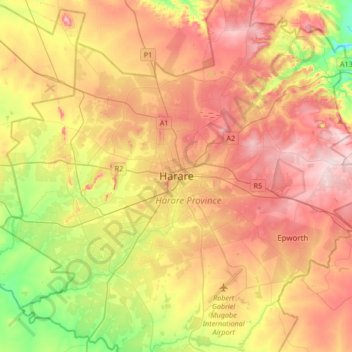
Name: Harare topographic map, elevation, terrain.
Location: Harare, Zimbabwe (-17.99177 30.88569 -17.67177 31.20569)
Average elevation: 1,470 m
Minimum elevation: 1,328 m
Maximum elevation: 1,603 m