

Leicestershire topographic maps
Click on a map to view its topography, its elevation and its terrain.
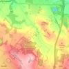
Oaks in Charnwood
United Kingdom > England > Leicestershire > North West Leicestershire
Average elevation: 155 m
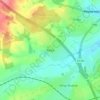
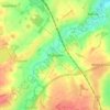
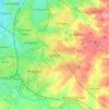


Halstead
United Kingdom > England > Leicestershire > Harborough > Tilton on the Hill > Halstead
Average elevation: 179 m


Great Easton
United Kingdom > England > Leicestershire > Harborough District > Great Easton
Average elevation: 72 m

Catthorpe
United Kingdom > England > Leicestershire > Harborough District > Catthorpe
Average elevation: 113 m


Ingarsby
United Kingdom > England > Leicestershire > Harborough District > Ingarsby
Average elevation: 139 m

Kilby Bridge
United Kingdom > England > Leicestershire > Oadby and Wigston > Wigston
Average elevation: 89 m


Eye Kettleby
United Kingdom > England > Leicestershire > Borough of Melton > Melton Mowbray
Average elevation: 95 m


Upper Bruntingthorpe
United Kingdom > England > Leicestershire > Harborough District > Walton > Upper Bruntingthorpe
Average elevation: 143 m

Bradgate Park
United Kingdom > England > Leicestershire > Charnwood > Newtown Linford
Overlying the Beacon Hill Formation, but found a little further down the hillside to the south, are the Bradgate Formation beds, the most notable of which is the Sliding Stone Slump Breccia rocks. Forming a line of crags below Old John, these are laminated mudstones, with layers of sandstone, mainly of…
Average elevation: 126 m


South Croxton
United Kingdom > England > Leicestershire > Charnwood > South Croxton
The highest point is the church, at 120 m above mean sea level. The lowest altitude is 85 m by the Queniborough Brook.
Average elevation: 108 m

Belvoir Castle
United Kingdom > England > Leicestershire > Melton > Belvoir
The traditional burial place of the Manners family was St Mary the Virgin's Church, Bottesford. Since elevation to the dukedom in 1703 most Dukes have been buried in the grounds of the mausoleum at Belvoir Castle. The mausoleum at Belvoir Castle was built by The 5th Duke of Rutland, following the death of his…
Average elevation: 82 m

Kegworth
United Kingdom > England > Leicestershire > North West Leicestershire
Average elevation: 47 m




Ravenstone
United Kingdom > England > Leicestershire > North West Leicestershire
Average elevation: 143 m

Donisthorpe
United Kingdom > England > Leicestershire > North West Leicestershire
From: A Topographical Dictionary of England, published by S Lewis, London, 1848.
Average elevation: 94 m
Breedon on the Hill
United Kingdom > England > Leicestershire > North West Leicestershire
Average elevation: 84 m




Higham on the Hill
United Kingdom > England > Leicestershire > Hinckley and Bosworth
Average elevation: 96 m

Barton in the Beans
United Kingdom > England > Leicestershire > Hinckley and Bosworth
Average elevation: 113 m




Ratcliffe Culey
United Kingdom > England > Leicestershire > Hinckley and Bosworth
Average elevation: 77 m

Sheepy Magna
United Kingdom > England > Leicestershire > Hinckley and Bosworth
Average elevation: 82 m
Fenny Drayton
United Kingdom > England > Leicestershire > Hinckley and Bosworth
Average elevation: 86 m

Willesley
United Kingdom > England > Leicestershire > North West Leicestershire
Average elevation: 110 m



Thringstone
United Kingdom > England > Leicestershire > North West Leicestershire
Average elevation: 126 m


