
沙羅の木 topographic map
Interactive map
Click on the map to display elevation.
About this map
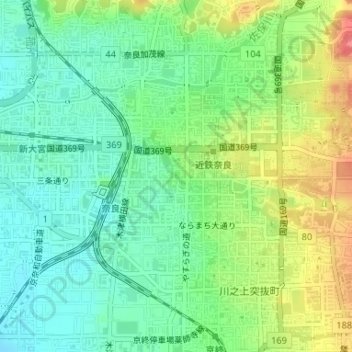
Name: 沙羅の木 topographic map, elevation, terrain.
Location: 沙羅の木, 三条通り, 上三条町, 奈良市, 奈良縣, 630-8236, 日本 (34.68220 135.82505 34.68230 135.82515)
Average elevation: 82 m
Minimum elevation: 57 m
Maximum elevation: 125 m
Other topographic maps
Click on a map to view its topography, its elevation and its terrain.