
Bangka-Belitung Islands topographic map
Interactive map
Click on the map to display elevation.
Bangka-Belitung Islands
Bangka Belitung is entirely surrounded by water. It is bordered by Natuna Sea to the north, Karimata Strait to the east, Java Sea to the south and Bangka Strait to the west. The natural state of Bangka Belitung province is largely a plateau, valley and a small portion of the mountains and hills. Lowland altitude average of about 50 metres (160 ft) above sea level and altitude mountain areas among others to Mount Maras reach 699 metres (2,293 ft) in Belinyu District, Bangka. Mount Tajam Kaki height is approximately 500 metres (1,600 ft) above sea level on the island of Belitung. As for the hilly areas like Bukit Menumbing reaches a height of approximately 445 metres (1,460 ft) in the Bukit Nenas and Mangkol district with a height of about 395 metres (1,296 ft) above sea level in the Pangkalan Baru district. Soil in Bangka Belitung generally has a pH or acidic soil reaction averaging below 5, but has a very high aluminium content. Within it are various minerals, such as tin, sand, quartz sand, granite, kaolin, clay, and others.
About this map
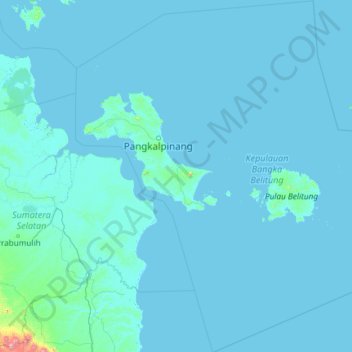
Name: Bangka-Belitung Islands topographic map, elevation, terrain.
Location: Bangka-Belitung Islands, Sumatra, Indonesia (-4.99936 104.99961 -0.27328 109.38979)
Average elevation: 14 m
Minimum elevation: -2 m
Maximum elevation: 2,123 m
Other topographic maps
Click on a map to view its topography, its elevation and its terrain.
Bandung
Indonesia > West Java > Bandung
Bandung, the capital of West Java province, located about 180 kilometres (110 mi) southeast of Jakarta, is the third-largest city in Indonesia. Its elevation is 768 metres (2,520 ft) above sea level and is surrounded by up to 2,400 metres (7,900 feet) high Late Tertiary and Quaternary volcanic terrain. The 400…
Average elevation: 879 m
East Java
East Java has a tropical monsoon and savanna climate at lower elevation and subtropical at higher elevation. Compared with the western part of Java Island, East Java in general has less rainfall. Average rainfall is 1,900 mm per year, with a rainy season during the 100 days. The average temperature ranges…
Average elevation: 66 m
PT Galangan Kapal Bontuni Tirtamas
Indonesia > Southeast Sulawesi > Kendari > Kessilampe
Average elevation: 23 m