
Klampok topographic map
Interactive map
Click on the map to display elevation.
About this map
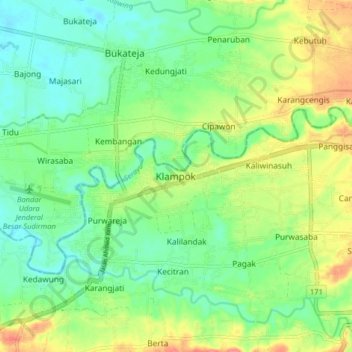
Name: Klampok topographic map, elevation, terrain.
Location: Klampok, Banjarnegara, Central Java, Java, 53382, Indonesia (-7.49689 109.40529 -7.41689 109.48529)
Average elevation: 54 m
Minimum elevation: 28 m
Maximum elevation: 97 m