
Changsha topographic map
Interactive map
Click on the map to display elevation.
About this map
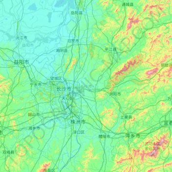
Name: Changsha topographic map, elevation, terrain.
Location: Changsha, Hunan, China (27.85121 111.89150 28.66442 114.25604)
Average elevation: 180 m
Minimum elevation: 19 m
Maximum elevation: 1,833 m
Auf der offiziellen Website der Stadt hieß es 2012, 800 Hochhäuser seien in den Jahren davor errichtet worden und 200 seien im Bau.[2][3] Zum Stand 2021 wurden für Changsha als Zahlen von Wolkenkratzern, d. h. Häuser ab einer Höhe von 150 m, 49 fertiggestellte und 10 im Bau angegeben.[4] Der höchste, der Changsha IFS Tower T1, ist mit 452,1 m das 16.-höchste Gebäude der Welt.[4]
Other topographic maps
Click on a map to view its topography, its elevation and its terrain.