
安乡县 topographic map
Interactive map
Click on the map to display elevation.
About this map
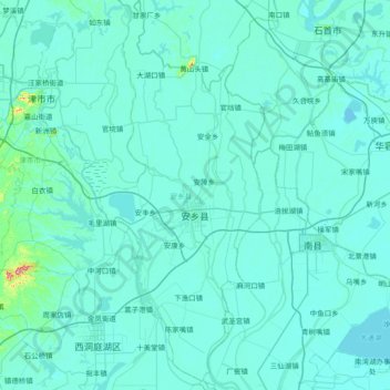
Name: 安乡县 topographic map, elevation, terrain.
Location: 安乡县, Changde, Hunan, China (29.12254 111.98240 29.77085 112.29847)
Average elevation: 35 m
Minimum elevation: 21 m
Maximum elevation: 352 m
Other topographic maps
Click on a map to view its topography, its elevation and its terrain.