
清江镇 topographic map
Interactive map
Click on the map to display elevation.
About this map
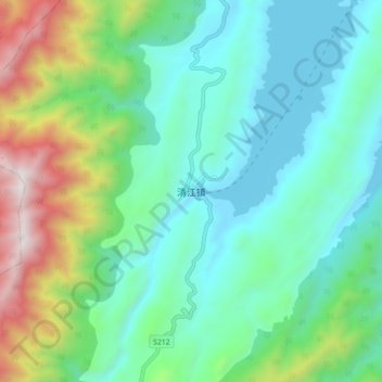
Name: 清江镇 topographic map, elevation, terrain.
Location: 清江镇, Chenzhou, Hunan, China (25.69924 113.25691 25.77924 113.33691)
Average elevation: 625 m
Minimum elevation: 272 m
Maximum elevation: 1,635 m