
淮阴区 topographic map
Interactive map
Click on the map to display elevation.
About this map
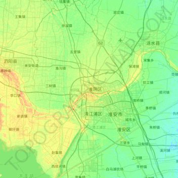
Name: 淮阴区 topographic map, elevation, terrain.
Location: 淮阴区, 淮安市, 江苏省, 223300, 中国 (33.34301 118.72081 33.92100 119.17737)
Average elevation: 11 m
Minimum elevation: 3 m
Maximum elevation: 28 m
Other topographic maps
Click on a map to view its topography, its elevation and its terrain.