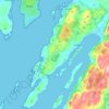
Minard topographic map
Click on the map to display elevation.
About this map
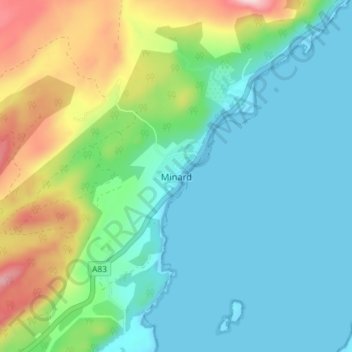
Name: Minard topographic map, elevation, terrain.
Location: Minard, Argyll and Bute, Scotland, PA32 8YR, United Kingdom (56.09705 -5.27277 56.13705 -5.23277)
Average elevation: 73 m
Minimum elevation: -1 m
Maximum elevation: 277 m
Other topographic maps
Click on a map to view its topography, its elevation and its terrain.




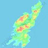


Gigha
United Kingdom > Scotland > Argyll and Bute > Ardminish
Gigha lies 5 kilometres (3 mi) off the coast of Kintyre and is 9.5 km (6 mi) long in a roughly north-south direction and a maximum of 2.5 km (1 1⁄2 mi) wide. The total area is 1,395 hectares (3,450 acres) and the highest elevation of Creag Bhàn reaches only 100 m (330 ft). The rocky central spine is…
Average elevation: 3 m





Loch Sunart to the Sound of Jura Marine Protected Area
United Kingdom > Scotland > Argyll and Bute
Average elevation: 135 m



Castle Sween
United Kingdom > Scotland > Argyll and Bute > Achnamara > Kilmichael of Inverlussa
Average elevation: 55 m
Minard Castle
United Kingdom > Scotland > Argyll and Bute > Minard > Tullochgorm
Average elevation: 34 m




Lismore
United Kingdom > Scotland > Argyll and Bute > Achnacroish
The island of Lismore lies in Loch Linnhe, north east of Mull, in the Argyll and Bute council area. It is 15 kilometres (9.3 mi) long and about 2 kilometres (1.2 mi) wide and oriented from SW to NE, roughly parallel to the Great Glen Fault. To the east is an arm of Loch Linnhe known as the Lynn of Lorn.…
Average elevation: 16 m




Castle Stalker
United Kingdom > Scotland > Argyll and Bute > Appin > Achosrigan
Average elevation: 32 m



Eilean Mhic Coinnich
United Kingdom > Scotland > Argyll and Bute > Portnahaven > Claddach
Average elevation: 8 m