Geolocate

Bute topographic map

Click on the map to display elevation.

About this map

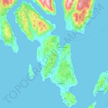
Name: Bute topographic map, elevation, terrain.

Location: Bute, Ardbeg, Argyll and Bute, Scotland, United Kingdom (55.72166 -5.22168 55.92675 -5.00106)

Average elevation: 41 m

Minimum elevation: -2 m

Maximum elevation: 461 m

Gear up for your next adventure:

🎒Hiking Backpacks - Durable backpacks for day hikes and multi‑day treks
🪶Down Jackets - Warm jackets for cold outdoor trips
🚴Mountain Bikes - Bikes for off‑road trails and terrain
🥾Lightweight Hiking Shoes - Light, breathable shoes for trail walking
🔦High-Lumen Headlamps - Hands-free lighting for early starts or late finishes

As an Amazon Associate, this site earns from qualifying purchases at no extra cost to you.