Geolocate

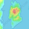
Luing topographic map

Click on the map to display elevation.

About this map

Name: Luing topographic map, elevation, terrain.

Location: Luing, Toberonochy, Argyll and Bute, Scotland, United Kingdom (56.18816 -5.66578 56.27083 -5.61762)

Average elevation: 13 m

Minimum elevation: -2 m

Maximum elevation: 260 m

Other topographic maps

Click on a map to view its topography, its elevation and its terrain.
Gear up for your next adventure:

🔋Lithium Batteries - Best performance for digital devices in cold weather
🧥Packable Down Jackets - High warmth-to-weight ratio for summit breaks
🪑Compact Camp Chairs - Comfortable seating after a long day of mapping
🧂Electrolyte Tablets - Stay hydrated during strenuous mountain climbs
🧺Collapsible Camp Bowls - Save space in your expedition kit

As an Amazon Associate, this site earns from qualifying purchases at no extra cost to you.