
輪島 topographic map
Interactive map
Click on the map to display elevation.
About this map
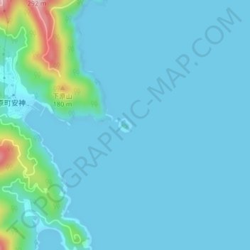
Name: 輪島 topographic map, elevation, terrain.
Location: 輪島, 对马市, 长崎县, 日本 (34.14359 129.28600 34.14517 129.28779)
Average elevation: 24 m
Minimum elevation: 0 m
Maximum elevation: 231 m
Other topographic maps
Click on a map to view its topography, its elevation and its terrain.