
平岳 topographic map
Interactive map
Click on the map to display elevation.
About this map
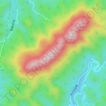
Name: 平岳 topographic map, elevation, terrain.
Location: 平岳, 对马市, 长崎县, 日本 (34.56800 129.37571 34.56810 129.37581)
Average elevation: 201 m
Minimum elevation: 34 m
Maximum elevation: 461 m
Other topographic maps
Click on a map to view its topography, its elevation and its terrain.