
白岳 topographic map
Interactive map
Click on the map to display elevation.
About this map
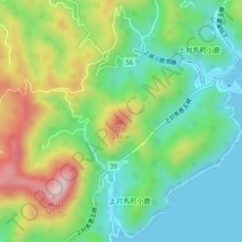
Name: 白岳 topographic map, elevation, terrain.
Location: 白岳, 对马市, 长崎县, 日本 (34.50944 129.42115 34.50954 129.42125)
Average elevation: 115 m
Minimum elevation: 0 m
Maximum elevation: 323 m
Other topographic maps
Click on a map to view its topography, its elevation and its terrain.