
Drumenny (Stewart) topographic map
Interactive map
Click on the map to display elevation.
About this map
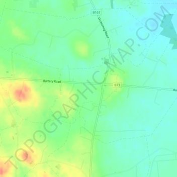
Name: Drumenny (Stewart) topographic map, elevation, terrain.
Location: Drumenny (Stewart), Northern Ireland, United Kingdom (54.63006 -6.56834 54.64073 -6.55025)
Average elevation: 31 m
Minimum elevation: 14 m
Maximum elevation: 62 m
Other topographic maps
Click on a map to view its topography, its elevation and its terrain.
Dunseverick Castle
United Kingdom > Northern Ireland > County Antrim > Dunseverick
Average elevation: 29 m
Derry/Londonderry
United Kingdom > Northern Ireland > County Londonderry
Derry is characterised by its distinctively hilly topography. The River Foyle forms a deep valley as it flows through the city, making Derry a place of very steep streets and sudden, startling views. The original walled city of Londonderry lies on a hill on the west bank of the River Foyle. In the past, the…
Average elevation: 88 m
Newtownstewart
United Kingdom > Northern Ireland > County Tyrone > Newtownstewart
Average elevation: 87 m
Ballyquinton Point nature reserve
United Kingdom > Northern Ireland > County Down
Average elevation: 2 m
Old Mill
United Kingdom > Northern Ireland > County Antrim > Ballygally > Old Mill
Average elevation: 47 m
Mountsandel
United Kingdom > Northern Ireland > County Londonderry > Coleraine
Average elevation: 25 m
Dungannon Fort
United Kingdom > Northern Ireland > County Londonderry > Castlerock > Downhill
Average elevation: 60 m
Jonesborough
United Kingdom > Northern Ireland > County Armagh > Jonesborough
Average elevation: 130 m