Geolocate

Limavady topographic map

Click on the map to display elevation.

About this map

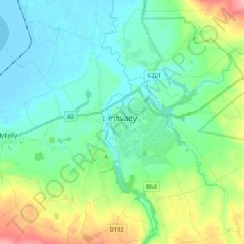
Name: Limavady topographic map, elevation, terrain.

Location: Limavady, County Londonderry, Northern Ireland, BT49 0EA, United Kingdom (55.01049 -6.99051 55.09049 -6.91051)

Average elevation: 37 m

Minimum elevation: -5 m

Maximum elevation: 151 m

Other topographic maps

Click on a map to view its topography, its elevation and its terrain.

Gear up for your next adventure:

🧊Winter Boot Traction - Grip for icy paths in the Mourne or Derryveagh mountains
🏕️Camping Chairs - Comfortable outdoor chairs for campsites
🎒Day Packs - Perfect packs for day trips
🚰Portable Water Filters - Safely drink from Irish streams and mountain lakes
Ultralight Hiking Tents - Compact shelters for multi-day wild camping in Ireland

As an Amazon Associate, this site earns from qualifying purchases at no extra cost to you.