Geolocate

Soignies topographic maps

Click on a map to view its topography, its elevation and its terrain.
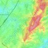
Casteau

Belgium > Hainaut > Soignies > Soignies

The valley of the Obrecheuil is in the east of the village. This part of the valley is part of Natura 2000 protected areas. The heart of the village is in the northwest higher part of the valley. The northwestern part of the village is a plain with dispersed houses and farms with typical hedges. The village is…

Average elevation: 98 m

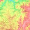
Marche-lez-Écaussinnes

Belgium > Hainaut > Soignies

Average elevation: 114 m

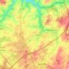
Coraimont

Belgium > Hainaut > Soignies > Braine-le-Comte

Average elevation: 111 m

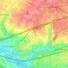
Soignies

Belgium > Hainaut > Soignies

Average elevation: 98 m

Seneffe

Belgium > Hainaut > Soignies

Average elevation: 122 m

Feluy

Belgium > Hainaut > Soignies > Seneffe

Average elevation: 112 m

Thieu

Belgium > Hainaut > Soignies

Average elevation: 93 m

Cognebeau

Belgium > Hainaut > Soignies > Soignies

Average elevation: 97 m

About this place

 •  •

Gear up for your next adventure:

🔪Multi‑Tools & Knives - Versatile tools for outdoor tasks
⛷️Mountain Sports Accessories - Gear for high intensity outdoor sports
🛌Cold Weather Sleeping Bags - Warm sleeping bags for colder hikes
🧢Waterproof Caps - Keep rain off your face and glasses while hiking
👣Orthopedic Boot Insoles - Extra comfort for long distance walking

As an Amazon Associate, this site earns from qualifying purchases at no extra cost to you.