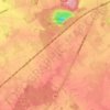
Seneffe topographic map
Click on the map to display elevation.
About this map

Name: Seneffe topographic map, elevation, terrain.
Location: Seneffe, Soignies, Hainaut, Wallonia, Belgium (50.49631 4.18618 50.60158 4.33646)
Average elevation: 122 m
Minimum elevation: 60 m
Maximum elevation: 169 m
Other topographic maps
Click on a map to view its topography, its elevation and its terrain.
Cité du Champ de l'Ange
Belgium > Hainaut > Soignies > Braine-le-Comte > Petit-Roeulx-Lez-Braine
Average elevation: 81 m