
葛山 topographic map
Interactive map
Click on the map to display elevation.
About this map
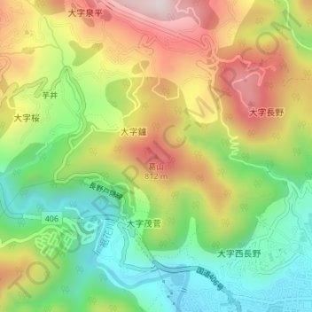
Name: 葛山 topographic map, elevation, terrain.
Location: 葛山, 長野市, 长野县, 380-0801, 日本 (36.67096 138.16651 36.67106 138.16661)
Average elevation: 604 m
Minimum elevation: 383 m
Maximum elevation: 876 m
Other topographic maps
Click on a map to view its topography, its elevation and its terrain.