
张家界市 topographic map
Interactive map
Click on the map to display elevation.
About this map
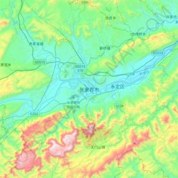
Name: 张家界市 topographic map, elevation, terrain.
Location: 张家界市, Yongding, Zhangjiajie, Hunan, China (28.95768 110.31414 29.27768 110.63414)
Average elevation: 482 m
Minimum elevation: 136 m
Maximum elevation: 1,487 m
Other topographic maps
Click on a map to view its topography, its elevation and its terrain.