
Changsha topographic map
Interactive map
Click on the map to display elevation.
About this map
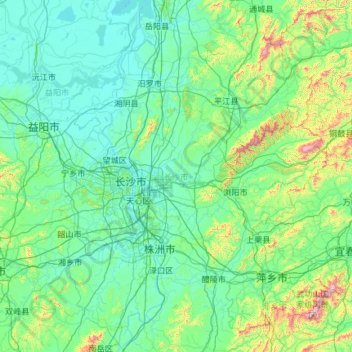
Name: Changsha topographic map, elevation, terrain.
Location: Changsha, Hunan, China (27.85121 111.89150 28.66442 114.25604)
Average elevation: 180 m
Minimum elevation: 19 m
Maximum elevation: 1,833 m
Other topographic maps
Click on a map to view its topography, its elevation and its terrain.